
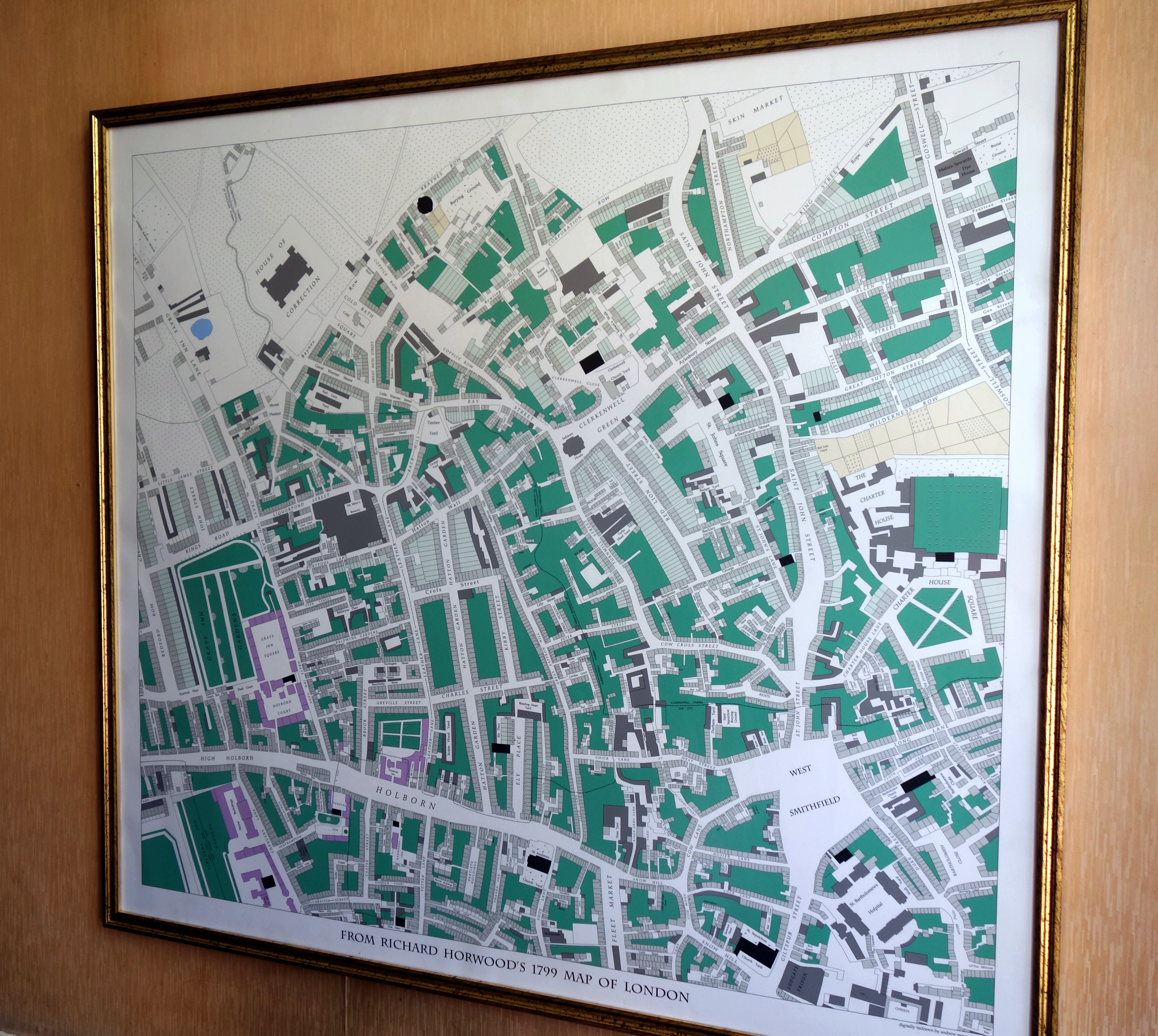
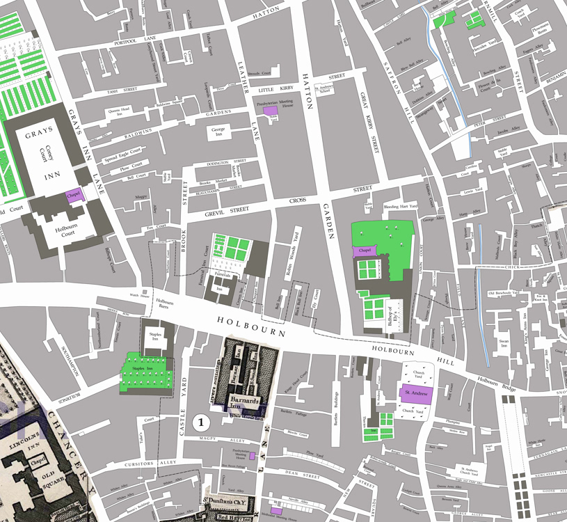
Recently installed in pride of place in our hallway is a new map — or, perhaps not so much a new map, but a new version of an old one. It’s a section of the great wall-map of London produced by Richard Horwood (1758-1803) between 1790 and 1799 — a section tailored to my own specifications and showing the area of Holborn and Clerkenwell between (roughly) Gray’s Inn and the Charterhouse — the streets my family lived in through six generations throughout most of the nineteenth century and a substantial portion of the twentieth.
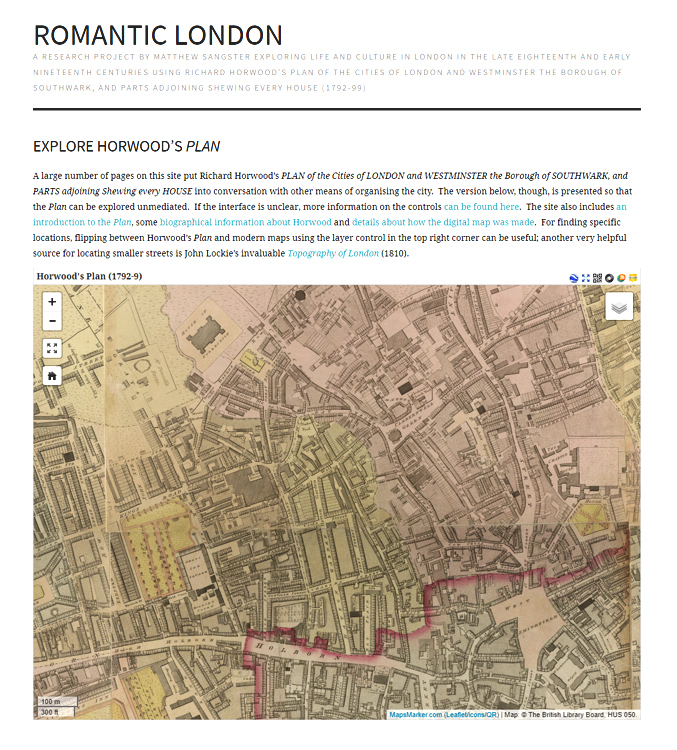
But in this version, it is not quite as published by Horwood. It has been digitally redrawn by Andrew Macnair, with the emphasis on a new level of clarity and utility. It is Horwood, but a new Horwood for the twenty-first century — affordable (far more affordable than the original), far clearer than the version in book form published by the London Topographical Society as The A to Z of Regency London (although that is also necessary for its excellent introduction by Paul Laxton) and it is there on the wall to be consulted without need of recourse to a major library. This digital version allows the map to be examined in all its detail — clearer still than the online version on the Romantic London website, although admittedly that has proved an absolutely invaluable resource in recent years.
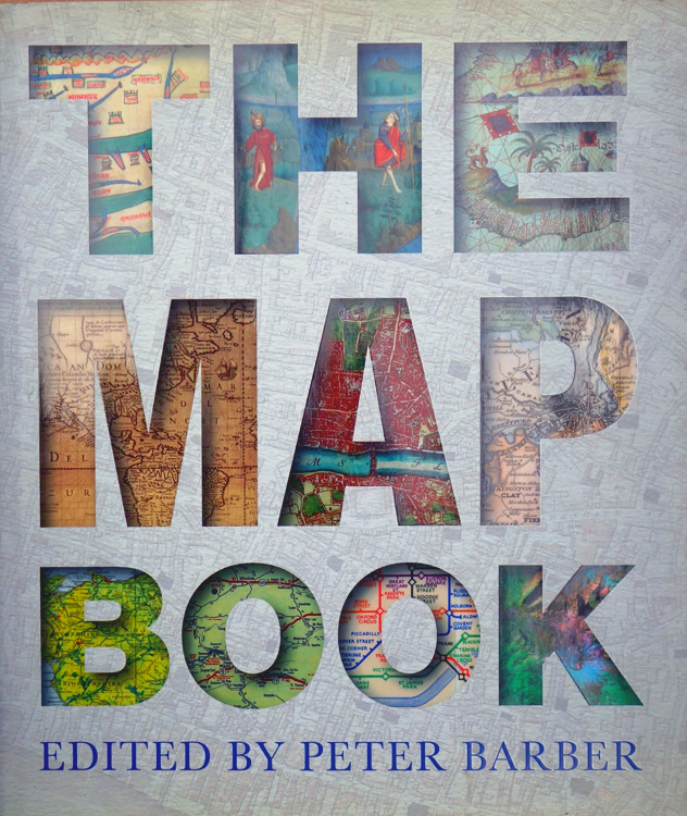
It is a map which has long been my favourite — I wrote about it as such in a piece for Peter Barber’s The Map Book back in 2005 (now there’s a book every map-lover should have). The Horwood map (part of it forms the grey background to the dust-jacket of The Map Book) was an extraordinary undertaking. In Horwood’s initial 1790 prospectus, he boldly announced that his map would show every single house in London — and not just show every house, but identify each one by name or street number. It was a claim never quite fully met, there are lapses and inconsistencies in the street numbering here and there — but fittingly enough, when the thirty-two sheets of the completed map of what was then the largest city in the world were fitted together, they became — at some thirteen feet by seven feet — the largest map ever produced in the British Isles. And the map became larger still when the plates passed to William Faden (1749-1836), who not only updated the map, adding in most of the missing street numbers, but also commissioned eight additional plates, extending the coverage to the docklands of an ever-expanding city. It is a truly breath-taking piece of work (anomalies and inconsistencies notwithstanding).
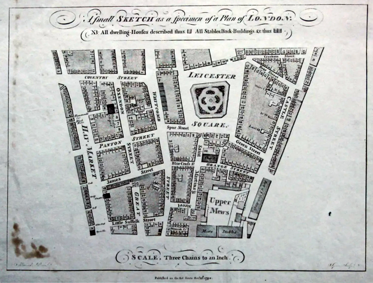
Completing the map cost Horwood dearly. The individual sheets, engraved on a lavish scale of twenty-six inches (66cm) to the mile, emerged piecemeal in a continuing saga of tribulation and vicissitude. Horwood eventually needed a loan of £500 from the Phoenix Fire Office to carry the work to completion in 1799. As he later recorded, “It is an Undertaking which cost me 9 years of the most valuable part of my Life — I took every Angle [and] meas.d almost every line”. How valuable that part of his life was, he was not yet to know: he lived only long enough to complete a similar map of Liverpool, where he died in 1803 to be buried in an obscure and forgotten grave.
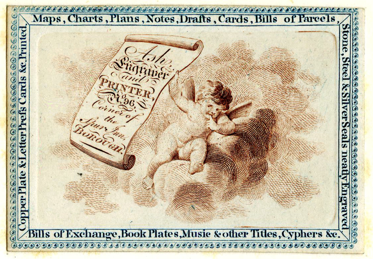
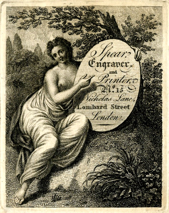
An indication of his need to pare costs is perhaps reflected in his choice of engravers. Three are known — John Ash, Richard Spear, and a third who has stubbornly refused identification and is known only by his initials — J. T. — although this is possibly John Thompson of Gutter Lane. All three are obscure. Ash worked south of the river in Adams Place, Borough. Spear, who engraved the 1790 specimen map to encourage subscribers, and at least four of the finished plates, worked in the back-streets of the City, off Lombard Street and Fenchurch Street. None of the three is known for any other map work, although in fairness it would be difficult to criticise their engraving for Horwood — it is admirably and precisely done.
Copies of all or part of the digitally redrawn map can be ordered directly from Andrew Macnair’s website richardhorwoodmapoflondon.co.uk — and can be customised to your own requirements — precise area, size you would like it, and even, I believe, as to the colour scheme. On my own example, the variegated shades of purple for public buildings, churches and chapels, etc., and the pale green for gardens, work well enough, but the darker green for undifferentiated areas between buildings almost certainly overstates the amount of vegetation in the area. Some were indeed parks or green spaces, but this was a working area — here were the workshops of watchmakers, instrument-makers, engravers, and the creators of luxury goods to be sold in the more fashionable parts of town — the City to the east, and the West End equidistant to the west. I suspect that many of these green areas were in reality yards and outbuildings hidden from street view. But the splendid thing about capturing the map in this way is that it is a work in progress, open to ongoing correction and improvement. And in any case, Andrew tells me he can “remove, or change, all the colours in an instant”.

Whether Horwood appeals or not, you might also like to have a look at Andrew’s other digitally redrawn maps: William Faden’s Map of Norfolk of 1797; and for the Greater London area, Faden’s The Country Twenty Five Miles Round London — a map once copied by the French War Department in preparation for an invasion. There are also Joseph Hodskinson’s map of Suffolk, published in 1783, the 1766 map of Hertfordshire by Andrew Dury and John Andrews, and John Chapman and Peter André’s 1777 survey of Essex.
Andrew has also let me have a sneak preview of his next map, John Rocque’s great map of the built-up part of London, dated 1746 (although not completed until the following year), work on which is proceeding apace, although it may take a while yet.

A most impressive initiative. I am particularly interested in the links with some of the great illustrated books on London – the Microcosm et al. Perhaps the Shepherd London prints that appeared in the Repository, a number of which also appeared in Papworth’s Views, could also be linked in.
Incidentally, my first job in London in the 1960s was as a Lloyd’s broker, and just around the corner was Jon Ash’s Bookshop, where amongst my early purchases were prints from the Microcosm – a book which I am now lucky enough to have in my own library.
LikeLike
Thank you for your comment. There is certainly scope for some integration of historic maps and historic views. Website owners take note.
LikeLike